


A food or beverage manufacturer signing a lease on a Dallas area industrial building is usually focused on ceiling height, dock door count, power capacity,...
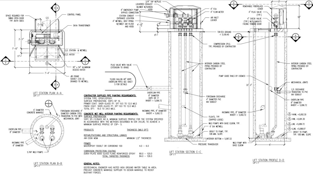
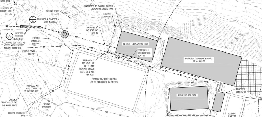
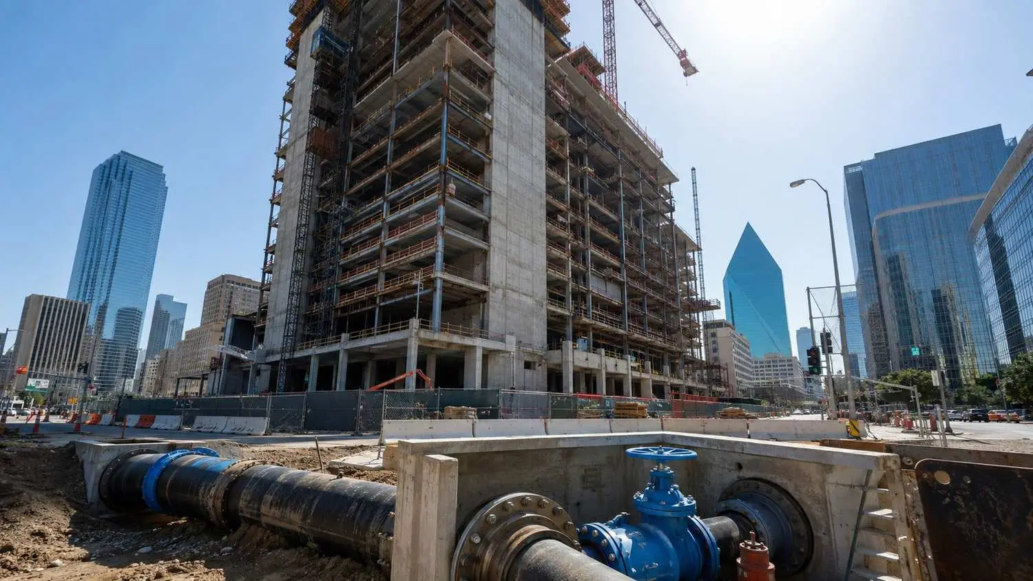
Read MoreA high rise project can have its architecture finalized, its financing closed, and its general contractor selected, and still run into a fire marshal review comment that stops the permit in its tracks because nobody modeled whether the existing water main can deliver adequate pressure to the twenty …